Map My Trip: How to Use 2024 Digital Maps for Effective Travel Planning
Table of Contents
Navigating the World with Mapping Tools
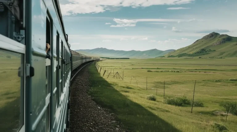
Travel planning has come a long way from paper maps and folding atlases. Today, the rise of digital mapping tools has transformed the way we explore the world, making trip planning more intuitive, visual, and efficient. Whether you’re plotting a cross-country road trip, exploring a new city, or venturing off the beaten path, mapping tools help you make sense of your journey by giving you real-time insights into routes, traffic, and even local attractions. This guide delves into how you can master the art of using digital maps, not only for navigation but for a richer, more comprehensive travel experience.
Choosing the Right Map My Trip Tool: Finding Your Travel Companion
With an abundance of mapping tools available today, selecting the right one for your trip can make all the difference. Whether you’re a globetrotter, a weekend warrior, or someone just trying to plan a hassle-free vacation, the tool you choose should align with your specific needs. Google Maps is the go-to choice for many due to its extensive features and real-time updates. Offering turn-by-turn navigation, live traffic data, and detailed street views, it’s particularly valuable for travelers seeking a comprehensive solution that spans both city streets and rural routes.
If you prefer simplicity, MapQuest is a straightforward option, ideal for point-to-point directions and quick access to driving routes. Meanwhile, for those who appreciate open-source contributions and flexibility, OpenStreetMap shines as a community-driven alternative that allows users to contribute real-time edits. It’s especially useful for areas less covered by mainstream apps or for niche adventures where trailheads and walking paths might not be well-documented on commercial maps.
Planning Your Route: Crafting Your Travel Blueprint
Once you’ve selected a Map My Trip tool, the next step is planning your route. Input your starting point and destination, and let the mapping tool show you a variety of routes, from the fastest highways to scenic detours. But don’t just settle for the default suggestion. Take time to explore different options.
For example, if you’re driving from Los Angeles to San Francisco, Google Maps may initially recommend the quickest route along I-5. But by exploring alternatives, you might discover a scenic coastal drive along Highway 1, which offers stunning views of the Pacific Ocean and the opportunity to visit iconic spots like Monterey and Big Sur. With a little extra time, your journey becomes more than just reaching a destination; it becomes an experience in itself.
Maximizing Your Experience by Adding Stops and Attractions
Mapping tools aren’t just for getting you from point A to point B—they’re also powerful resources for turning your trip into a well-rounded adventure. When plotting your route, take advantage of the ability to add multiple stops. If you’re driving through an unfamiliar area, consider using the “Add Stop” feature to incorporate must-see landmarks, local restaurants, or quirky roadside attractions.
For example, a road trip through Arizona might include stops at Horseshoe Bend, Antelope Canyon, and the lesser-known Wupatki National Monument. Each of these locations offers a unique slice of the region’s natural beauty and cultural history. Most mapping tools also provide ratings and reviews for each stop, helping you make informed decisions about where to spend your time.
Customizing Your Map my trip skill: Making It Uniquely Yours
Customization is where mapping tools truly come alive. Gone are the days of generic directions. Today’s digital maps allow you to personalize your route by adding notes, photos, and even local recommendations. Google Maps, for example, lets you create custom maps where you can mark favorite spots, add personalized labels, and share your maps with friends or fellow travelers.
This is particularly useful for group trips. If you’re traveling with family or friends, you can collaborate on the map by suggesting restaurants, adding pit stops, or identifying key places you’d like to explore together. Sharing your map allows everyone to stay in the loop, ensuring the group remains coordinated while still allowing room for individual exploration.
Offline Maps for Remote Adventures: Staying Connected When You’re Not
One of the most overlooked but essential features of modern mapping tools is the ability to download maps for offline use. This can be a game-changer, especially when traveling to remote areas where cell service may be spotty or non-existent. Whether you’re hiking in the Appalachian Mountains or exploring remote villages in Thailand, having offline maps ensures you’re never truly lost, even without internet access.
Before heading into remote regions, download the relevant maps directly to your device. Most tools, including Google Maps, allow you to select a specific area and save it for later use. Offline maps provide full navigation capabilities, including turn-by-turn directions and point-of-interest information, making them indispensable for travelers who enjoy off-grid adventures.
Seamless Integration with Other Travel Apps: All-in-One Travel Management
Travel is more than just navigation—it’s an orchestrated symphony of bookings, weather forecasts, event schedules, and reservations. Why not integrate your maps with other useful travel apps to keep everything at your fingertips?
For instance, syncing your maps with a travel itinerary app, like Easytrip.ai, allows you to have all your travel details in one place, from flight times to hotel reservations. Likewise, using weather apps such as AccuWeather alongside your maps helps you stay ahead of sudden weather changes, ensuring you’re prepared with the right gear for your activities. For cultural insights, add apps like Google Translate to your mapping tool for seamless interaction with locals and signage.
Navigating Public Transit: Effortless Travel in Urban Jungles
In dense urban environments, public transit is often the most efficient way to get around. Mapping tools like Google Maps or Citymapper provide comprehensive information on bus and metro systems, including route times, transit changes, and ticket prices. This feature is invaluable when traveling to major cities like Tokyo, New York, or Paris, where learning the intricacies of the local transit system can feel overwhelming.
For instance, in New York City, knowing which subway line to take is only half the battle. Mapping tools also provide real-time updates on delays, route closures, and alternative options, ensuring you avoid unnecessary stress during your travels. The ability to sync transit schedules with your maps makes navigating the complexities of public transportation much simpler.
GPS for the Great Outdoors: Navigating the Wilderness
If your travels lead you into nature, then GPS mapping is your most reliable guide. When hiking or trekking in remote regions, using GPS tools like Gaia GPS or Google Maps’ offline feature can be the difference between a successful adventure and a disorienting experience. Whether you’re trekking in Patagonia or navigating Zion National Park, having a reliable GPS system that allows you to mark waypoints, track your path, and measure elevation is crucial for safety and enjoyment.
These tools also allow you to record your hikes or adventures, so you can revisit the exact route later or share it with fellow explorers. In some cases, you can even access trail reviews or conditions left by other hikers, helping you better prepare for what’s ahead.
Sharing Your Travel Maps: Connecting with Others
Travel is often a shared experience, and mapping tools make it easier than ever to stay connected with friends, family, or fellow travelers. By sharing your customized maps, you can give others real-time updates on your journey or provide recommendations based on your experiences. Whether you’re keeping loved ones informed of your location or collaborating with friends on a multi-destination trip, shared maps streamline communication and planning.
For those looking to inspire fellow adventurers, publishing your travel maps can also be a fun way to share tips, routes, and hidden gems with a broader audience. Consider uploading your map to travel blogs or social media platforms to help others navigate destinations you’ve already explored.
Conclusion: Embrace the Power of Digital Maps for Travel
Mapping tools have fundamentally changed the way we plan and experience travel. No longer just for navigation, they’ve evolved into powerful platforms that allow us to customize routes, discover hidden gems, integrate with travel apps, and share our experiences with others. By fully embracing these digital tools, you’ll not only streamline your travel planning process but also open the door to richer, more immersive travel experiences. Whether you’re navigating a busy metropolis or hiking through untamed wilderness, your map is no longer just a guide—it’s your personalized travel companion.
TL;DR: Maximizing the Use of Digital Maps for Travel
Leverage digital maps to plan your trip thoroughly, from route planning with stops to navigating public transit and sharing your journey. These tools not only simplify logistics but also enrich your travel experience by seamlessly integrating vital travel information.
FAQ Section
What are the best free mapping tools for travel planning?
Google Maps and OpenStreetMap are highly recommended for their comprehensive features and ease of use.
How can I ensure my privacy while using online mapping tools?
Use privacy-focused settings, avoid sharing location data unnecessarily, and consider using VPNs if accessing maps in sensitive or restrictive environments.
Can I use these mapping tools on multiple devices?
Yes, most modern mapping tools are designed to synchronize across multiple devices, allowing seamless access whether you’re on a desktop or mobile.
Closing Remarks
Thank you for exploring how to effectively map your trip with this guide. With the right tools and knowledge, you’re now ready to tackle any travel challenge that comes your way. Safe travels and happy mapping!
NEED A PERSONALIZED TRIP PLAN TO ANOTHER DESTINATION?
A travel writer with a background in cultural anthropology, passionate about immersing myself in local cultures and uncovering hidden gems. My articles offer a deeper understanding of the places I visit, blending insightful cultural reflections with practical travel tips.
For more details, check:
Interview author Olivia
Have any questions? Please use our live chat, or visit our FAQ or Support Center for help.
To provide the best experiences, we use technologies like cookies to store and/or access device information. Consenting to these technologies will allow us to process data such as browsing behavior on this site. Not consenting or withdrawing consent, may adversely affect features and functions.
Functional
Always active
The technical storage or access is strictly necessary for the legitimate purpose of enabling the use of a specific service explicitly requested by the subscriber or user, or for the sole purpose of carrying out the transmission of a communication over an electronic communications network.
Preferences
The technical storage or access is necessary for the legitimate purpose of storing preferences that are not requested by the subscriber or user.
Statistics
The technical storage or access that is used exclusively for statistical purposes.The technical storage or access that is used exclusively for anonymous statistical purposes. Without a subpoena, voluntary compliance on the part of your Internet Service Provider, or additional records from a third party, information stored or retrieved for this purpose alone cannot usually be used to identify you.
Marketing
The technical storage or access is required to create user profiles to send advertising, or to track the user on a website or across several websites for similar marketing purposes.