Introduction
I’ve always been enchanted by Scotland’s rugged landscapes and rich mythology. This time, I decided to embark on a journey to its lesser-known isles, armed with Google Maps to plan my trip. What unfolded was a profound exploration of natural beauty and ancient lore, as Google Maps not only guided my way but also revealed hidden gems along the route. This journey through Scotland’s islands promised an adventure filled with discovering ancient ruins, tasting local whiskies, and experiencing wild, untouched landscapes that photographs can scarcely do justice.

Why Scotland’s Isles?
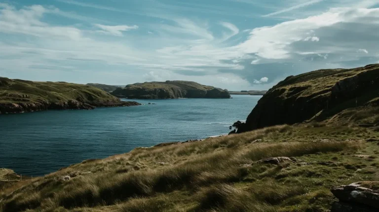
Scotland’s islands are steeped in mystery and history, each offering a unique glimpse into the country’s diverse heritage and natural beauty. These remote parts promised an adventure unlike any other, filled with ancient ruins, local whisky distilleries, and landscapes that seem to leap out of fairy tales. From the haunting beauty of the Isle of Skye to the cultural richness of the Outer Hebrides and the ancient mysteries of the Orkney Islands, each destination held the promise of unique experiences and profound discoveries.
Planning the Itinerary with Google Maps
To start my adventure, I opened Google Maps to plan my trip, charting a course from Glasgow to the Isle of Skye and beyond. Google Maps was invaluable in helping me visualize my route, calculate travel times, and mark essential stops like ferry points, accommodations, and places of interest. This initial planning stage was crucial in ensuring that my journey would be as smooth as it was scenic.
Using Google Maps, I could easily plan my routes, find the best travel times, and even discover lesser-known attractions along the way. The ability to save locations and create a custom itinerary ensured that I had a clear plan but also the flexibility to explore unexpected finds. I marked out ferry schedules, checked driving distances, and found accommodations that ranged from cozy B&Bs to rustic cottages, all thanks to the detailed information available on Google Maps.
Day 1-2: The Magical Isle of Skye
My first major stop was the Isle of Skye, known for its rugged landscapes and medieval castles. Google Maps led me to some of the less frequented spots like the Fairy Pools and the Quiraing, a dramatic landslip offering some of the most stunning views on the island. The Fairy Pools, with their crystal-clear waters and scenic backdrop, provided a magical start to my adventure. The hike to the pools was straightforward, thanks to the precise directions from Google Maps.
The Quiraing, on the other hand, presented a more challenging but equally rewarding experience. This area is known for its unique rock formations and sweeping vistas. Google Maps helped me navigate the winding roads and trails, ensuring I made the most of my visit. The ability to save these locations on Google Maps ensured I didn’t waste time navigating, giving me more freedom to immerse myself in the island’s enchanting beauty.
In the evenings, I used Google Maps to find local dining spots. One memorable recommendation was The Three Chimneys, a renowned restaurant offering delectable local cuisine. The app’s reviews and photos helped me choose this spot, and it did not disappoint. Fresh seafood and traditional dishes made for a perfect end to my days of exploration.
Day 3-4: Exploring the Outer Hebrides
Next on my itinerary planned via Google Maps was a trip to the Outer Hebrides, a chain of islands with rich Gaelic heritage. The journey to these remote islands required careful planning, and Google Maps guided me seamlessly to ferry services that connected the isles. On Lewis and Harris, I followed a route mapped on Google Maps to the Callanish Standing Stones, an ancient site older than Stonehenge. The drive through the islands offered stunning coastal views and rugged landscapes, each more breathtaking than the last.
The Callanish Standing Stones were a highlight, with their mysterious arrangement and ancient history. Walking among these stones, I felt a deep connection to the past. Google Maps also pointed me to local artisans, such as Harris Tweed weavers, where I could see traditional craftsmanship in action and purchase unique souvenirs.
The beaches of Harris, particularly Luskentyre, were another gem. Google Maps helped me find these remote spots, which were often missed by typical tourist guides. The white sands and turquoise waters were a stark contrast to the rugged terrain, offering a serene escape.
Day 5-6: The Orkney Islands’ Ancient Mysteries
The Orkney Islands were next, a place brimming with ancient history. Using Google Maps to plan my trip helped me efficiently manage my time between visiting the Neolithic village of Skara Brae and the mysterious Ring of Brodgar. The app’s real-time weather updates ensured I avoided rain and could enjoy exploring the windy, mystical landscapes that Orkney is famous for.
Skara Brae, a remarkably well-preserved prehistoric village, offered a glimpse into life over 5,000 years ago. The layout of the village, with its stone-built houses, was fascinating. Google Maps provided detailed routes and information about nearby attractions, enhancing my visit. The Ring of Brodgar, an ancient stone circle, was equally captivating. Walking among these ancient stones, I could almost hear the whispers of the past.
In addition to the historical sites, Orkney is known for its wildlife. Google Maps led me to the cliffs of Yesnaby, where I could observe seabirds and enjoy stunning coastal views. The app also helped me find local eateries, such as a charming cafe in Stromness, where I enjoyed traditional Orkney fare.
Day 7: Return to Edinburgh
As my journey neared its end, I returned to Edinburgh, using Google Maps to find a scenic route back that offered stops at historic sites and some excellent local eateries that were highly rated on the app. This last leg of the trip was a time to reflect on the adventures and the stories of the isles, with each destination brought to life through meticulous planning using Google Maps.
One notable stop was Stirling Castle, where I took a guided tour to learn about its strategic importance and historical events. The castle’s grandeur and the views from its ramparts were a fitting finale to my journey. Another stop was at the Kelpies, massive horse-head sculptures near Falkirk, which were both impressive and awe-inspiring.
Back in there, I explored areas I had missed initially, such as the charming Dean Village and the bustling Leith Walk. Google Maps helped me navigate the city efficiently, ensuring I made the most of my final day. I visited the National Museum of Scotland, where interactive exhibits provided a deeper understanding of Scotland’s rich history.

Local Cuisine and Hidden Gems
Throughout my travels, Google Maps was not just a navigation tool; it was a gateway to discovering hidden gems. In each locale, I used the app to find the best eating spots, from quaint cafes in Portree to seafood restaurants in Oban, enhancing my culinary experience and providing a taste of local flavors that were as memorable as the landscapes.
In Skye, a recommendation from Google Maps led me to the charming Cafe Arriba, where I enjoyed a hearty breakfast with a view of the harbor. In the Outer Hebrides, I discovered a small, family-run restaurant in Tarbert, where the seafood chowder was unforgettable. Orkney’s local specialties, such as Orkney beef and fresh crab, were highlights, thanks to the app’s top-rated suggestions.
Using Google Maps, I also uncovered local attractions that weren’t on my initial itinerary. From hidden waterfalls to quaint historical sites, these discoveries added depth and richness to my journey. The app’s user reviews and photos helped me choose activities and dining options that enhanced my overall experience.
Conclusion
My journey through Scotland’s lesser-known isles was a profound exploration of natural beauty and ancient lore, made seamless by the meticulous planning capabilities of Google Maps. Each island offered unique experiences, from the mystical landscapes of Skye to the ancient mysteries of Orkney and the cultural richness of the Outer Hebrides. The app’s detailed routes, real-time updates, and recommendations ensured that every moment was well-spent and every discovery was enriching. Whether navigating rugged trails, finding hidden gems, or savoring local cuisine, Google Maps was an indispensable companion on this unforgettable adventure. So, if you’re dreaming of a solo journey through Scotland’s rugged and magical isles, let Google Maps guide your way—an epic adventure awaits!
Enhancing My Journey with EasyTrip.ai
While Google Maps was instrumental in planning my trip, integrating EasyTrip.ai added an extra layer of personalization. The platform’s AI-driven recommendations helped me discover activities and events tailored to my interests, ensuring my travel experience was not only planned but also personalized.
Further Reading
For those interested in further exploring the use of digital tools in travel planning or learning more about Scotland’s Isles, consider these resources:
Happy traveling! From EasyTrip.ai with love
FAQ:
How does EasyTrip.ai complement Google Maps for travel planning?
EasyTrip.ai enhances Google Maps by providing personalized activity recommendations based on your interests and real-time conditions, ensuring a more tailored and enriched travel experience.